The Prelude to War adventure is mostly a wilderness adventure that takes place in hilly or mountainous terrain. As I work on it, I can’t help but notice the significant impact elevation has on distance.
Maps, especially gaming maps, are two-dimensional. This is a problem when you start talking about hills and mountains because differences in elevation can dramatically increase the actual distance travelers must walk. Not only because impassible terrain features force travelers into circuitous routes, but also because differences in elevation are not depicted accurately on a two-dimensional map.
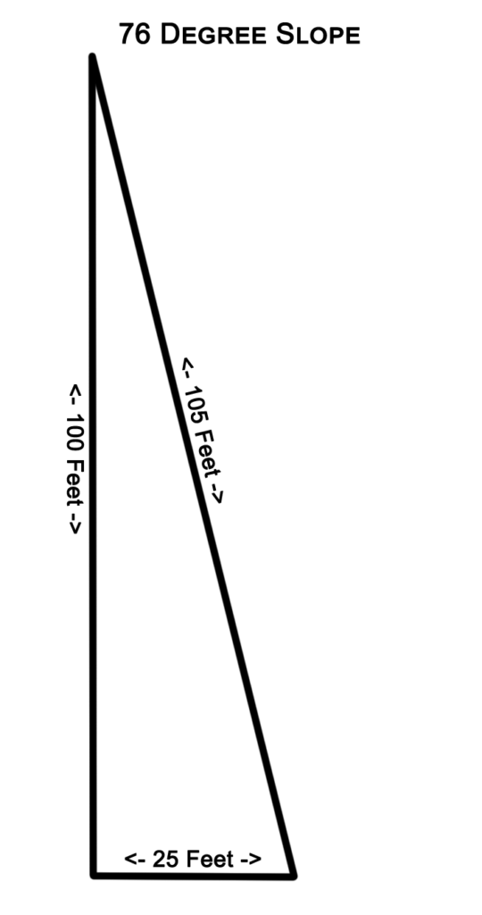
This diagram represents the cross-section of a hill in the upcoming Prelude to War adventure. The hill is 100 feet high and slopes at 76 degrees. Looking at this same hill from the top down in two dimensions, it would appear that it is only 25 feet from the top of the hill to the base. However, as the diagram shows, it is actually 105 feet – more than four times as far as it appears on the map.
Furthermore, the hill is so steep that a path or road would almost never run straight down the slope. A road or path would more likely switchback its way up the hillside, reducing the angle travelers have to climb, but extending the distance even more. If we assume the switchback path doubles the distance between the top and the bottom, travelers would have to walk 210 feet to traverse this slope – almost ten times farther than what appears in a two-dimensional map.
Example 1
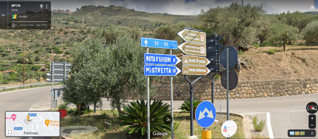
The distance between Pettineo and Motta D’affermo looks like about 1 mile on the map. Note that even the map shows the roads are not straight. Following the roads, it appears to be about 5 miles from Pettineo to Mistretta.
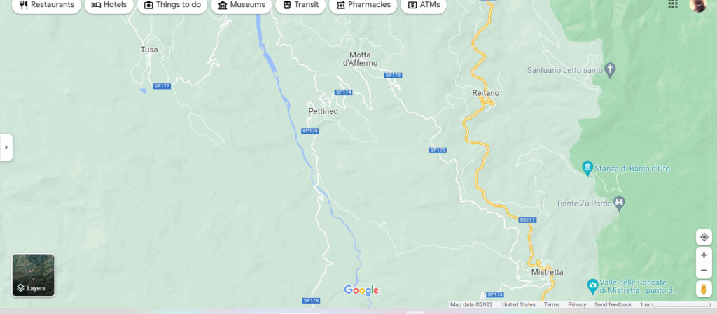
However, this street sign in Pettineo indicates it is actually 6 km or 3.7 miles from Pettineo to Motta D’affermo; almost 4 times farther than the map suggests. The sign also says it is 18 km or 11 miles from Pettineo to Mistretta, more than twice as far as the map indicates.
Example 2
When the roman army marched into the regions of Berenice in southern Egypt (a place where some Amazons vs Valkyries adventures occur), they complained about the extreme distance they had to walk through a scorching desert. According to the Roman sources, it took the army 11 days to reach Berenice from Coptos (modern Qus on the map, north of Luxor).
On the map it looks like a distance of 220 miles (the ancient road went straight across the desert from Coptos to Bernike Troglodytica). Concerning the Romans’ experience with this road, the Wikipedia states, “The road across the desert from Coptos was 258 Roman miles long, or 11 days’ journey.”
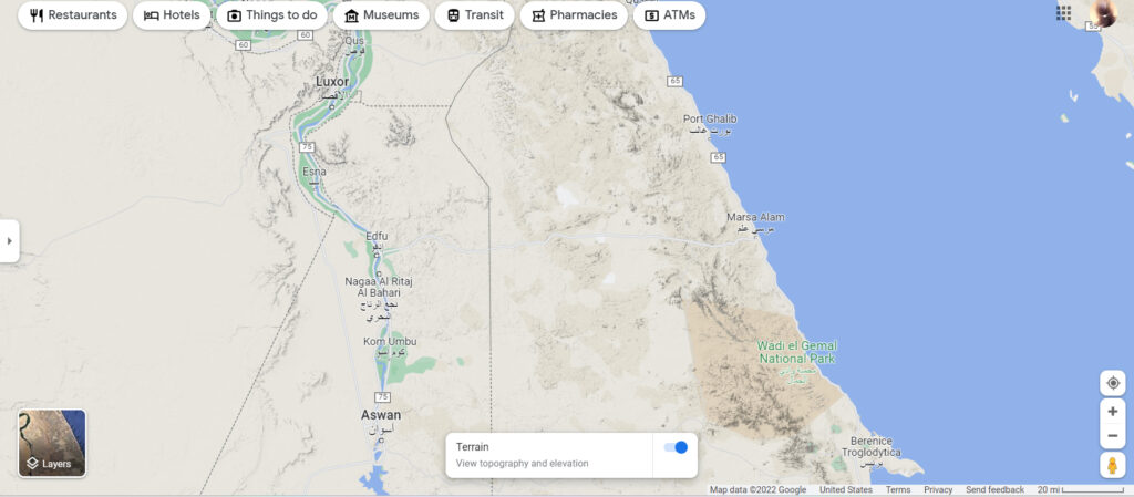
258 Roman miles is 1,290,000 feet or 244 modern miles which is about 11% further than what appears on the map. However, much of this journey is through the desert, with only the last third or so being in hilly terrain.
As the Crow Flies
This elevation effect is another reason why flying is faster. The old adage about a crows’ flight is even more relevant when you consider how steep terrain increases the distance for terrestrial creatures. This, of course, is leveraged a lot in high level AvV adventures where all the characters have flying mounts.
Armies
This is also why straight, flat, paved roads with bridges and tunnels are such an advantage for armies moving over great distances. Moving along such causeways is much faster than using secondary roads and paths.
Conclusion
Overland travel distance between any two points in hilly terrain is at least double what a two-dimensional map indicates. In mountainous terrain, the distance is at least quadrupled and could be as much as ten times farther than what appears on a two-dimensional map. However, some main roads are so well built that they overcome these terrain obstacles. There are three such roads in the Prelude to War adventure. Distances on all other roads, paths, and trails are actually twice as far as what appears on the map.